rareoldprints.com


Search

If you know the reference number
enter it here:


If you enter more than one word
it will be treated as phrase.

Insert "and" or "or" between words to search for the words in any order.

Refine your search here or build another search.
Displaying 0 to 6 of 6 - -
96%
Dept. de la Manche.
Ref: P/13641
Region: Manche
Type: Steel
Cartographer: Levasseur V
Engraver: Beaurain

95%
Dept. de la Manche
Ref: P/6544
Region: Manche
Type: Steel
Cartographer: Levasseur V

Sold
87%
A Map of the Country round Cherburg in Normandy
Ref: P/11367
Region: Cherbourg
Type: Copper
Cartographer: Kitchin T
Date: 1758

86%
Ville et Port de Cherbourg
Ref: P/30238
Region: Cherbourg
Type: Chromo-lithograph
Engraver: Hausermann R
Publisher: Artheme Fayard, Editeur Bol St. Michel 78
Date: 1877

85%
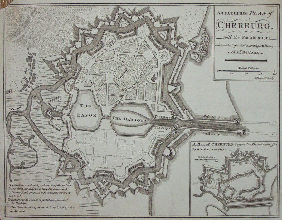
An accurate Plan of Cherburg with the Fortifications as intended to be finished according to the Design of Mr. De Caux.
Ref: P/6596
Region: Cherbourg
Type: Copper
Engraver: Bennett R
Publisher: R Griffiths
Date: 1758

82%
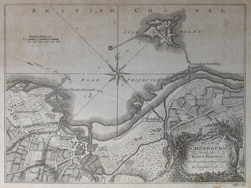
Plan of Cherbourg with the Ports & Batteries when taken by the English in August 1758
Ref: P/4578
Region: Cherbourg
Type: Copper
Engraver: Hilton
Date: 1758


Displaying 0 to 6 of 6